Castle Leazes
Castle Leazes
HER Number
1358
District
Newcastle
Site Name
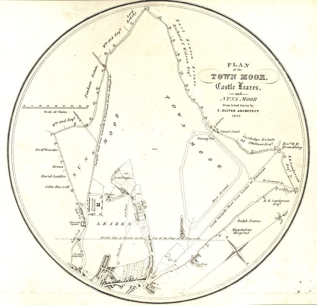
Castle Leazes
Place
Newcastle
Map Sheet
NZ26NW
Class
Agriculture and Subsistence
Site Type: Broad
Common Land
Site Type: Specific
Common Land
General Period
MEDIEVAL
Specific Period
Medieval 1066 to 1540
Form of Evidence
Documentary Evidence
Description
Apparently alternatively known as Castle Field, this was the southernmost part of Newcastle's common (leaze pasture). It lay west of the houses on Gallowgate and Percy Street, south of Pandon (Bailey) Burn, and north of Barrack Road, perhaps the boundary with Elswick. Its western edge not clear. It is reached from the town by Leazes Park Road. The origin of part of it was perhaps the same as the Town Moor, i.e. it was once nuns' land given to the burgesses in 1213. Some, however, was bought - in 1681 and 1701. Today it consists of Leazes Park, Castle Leazes & associated grassland, various building complexes such as Leazes Terrace and Crescent, St James’s Park, the RVI, university Medical and Dental Schools, university halls of residence, and Claremont Place. The Park is both a Conservation Area and Listed Park and Garden.
Easting
424000
Northing
565000
Grid Reference
NZ424000565000
Sources
<< HER 1358 >> H. Bourne, 1736, History of Newcastle 147-8
J. Brand, 1789, History of Newcastle, I, 431 n.i, 437-40
A.M. Oliver, 1924, Ancient Newcastle Deeds 1377, Surtees Society, p. 4
S. Middlebrook 1950 Newcastle upon Tyne passim
Tyne and Wear Archives Service NCP - - Chimney Mills 7.1
Tyne and Wear Archives Service NCP - - Leazes Park 4.133
Tyne and Wear Archives Service NCP - - Spital Tongues 7.15; Grace McCombie, 2009, Newcastle and Gateshead - Pevsner Architectural Guide, p. 34; Barbara Harbottle, 2009, The Medieval Archaeology of Newcastle in Diana Newton and AJ Pollard (eds), 2009, Newcastle and Gateshead before 1700, page 38