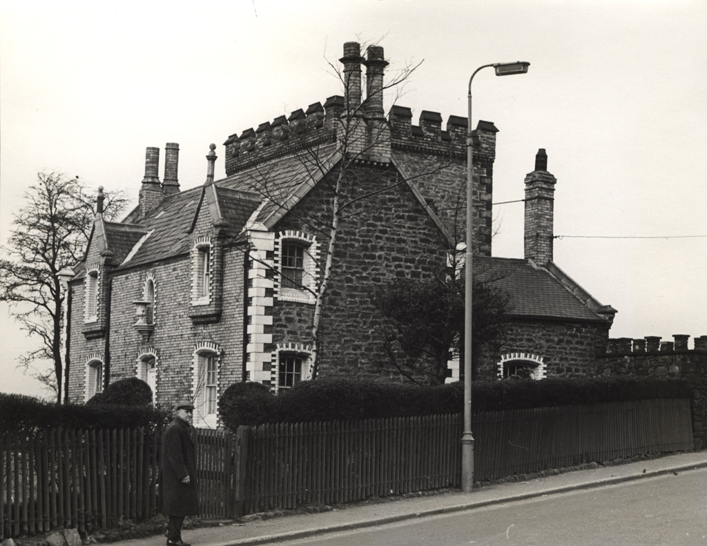
Scotswood Tower
Scotswood Tower
HER Number
1877
District
Newcastle
Site Name
Scotswood Tower
Place
Scotswood
Map Sheet
NZ16SE
Class
Domestic
Site Type: Broad
House
Site Type: Specific
Detached House
General Period
POST MEDIEVAL
Specific Period
Victorian 1837 to 1901
Form of Evidence
Demolished Building
Description
Little is known of this curious Victorian house, apparently built on to an ancient tower. Although research by Farrier has suggested that the tower was contemporary with the remainder of the house rather than a medieval building. Tower House is identified on the 1st edition Ordnance Survey as a single building. By 1863, it is referred to Scotswood Tower in a newspaper advertisment. In the 2nd edition Ordnance Survey, the tower and additional outbuildings are referred to as Scotswood Tower. The property is recorded in the Blackett-Ord land sale of 1920 as a "house rented to Mrs Hall...... stables and garden rented to eleven others". It stood on the western side of Denton Road near the location of the present Sports and Social Club and was demolished in 1981.
Easting
419760
Northing
564250
Grid Reference
NZ419760564250
Sources
<< HER 1877 >> T. Faulkner & P. Lowery, 1996, Lost Houses of Newcastle and Northumberland, p 28
Notes from I. Farrier - West Newcastle Picture History Collection
Notes from I. Farrier - West Newcastle Picture History Collection