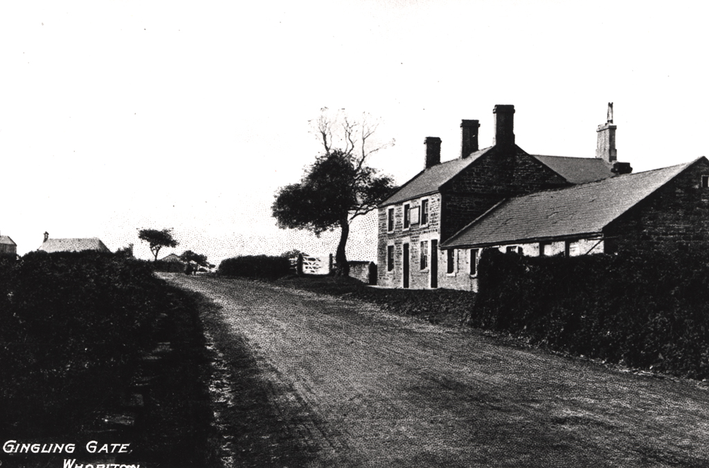
Gingling Gate Public House
Gingling Gate Public House
HER Number
6878
District
Newcastle
Site Name
Gingling Gate Public House
Place
Whorlton
Map Sheet
NZ16NE
Class
Commercial
Site Type: Broad
Eating and Drinking Establishment
Site Type: Specific
Public House
General Period
POST MEDIEVAL
Specific Period
Victorian 1837 to 1901
Form of Evidence
Extant Building
Description
Shown on tithe map of 1847. May have originally been called the Blue Bell. Held by Riddell Robson (farmer at Low Whorlton and West and East Whorlton). Shown on 1st edition Ordnance Survey map with a smithy to the rear (HER 3995). The Jingling Gate Public House is still there but the 19th century building is hidden under a mock 'Tudorbethan' façade, a porch has been added, the gable end window blocked up and the sash windows replaced by plastic frames. Remodelled in mid 1930s and extended by Vaux in 1958.
Easting
418750
Northing
567840
Grid Reference
NZ418750567840
Sources
<< HER 6878 >> Ordnance Survey first edition map, 1850; Whorlton Tithe Map 1847 (Woodhorn NRO DT 509 M); J.T. Allison and A.D. Walton, 1989, Bygone Westerhope, p 21; Bennison, B, 1998, Lost Weekends, A History of Newcastle's Public Houses, Vol 3, The West