Elswick Road, Presbyterian Church
Elswick Road, Presbyterian Church
HER Number
6320
District
Newcastle
Site Name
Elswick Road, Presbyterian Church
Place
Elswick
Map Sheet
NZ26SW
Class
Religious Ritual and Funerary
Site Type: Broad
Place of Worship
Site Type: Specific
Presbyterian Chapel
General Period
POST MEDIEVAL
Specific Period
Victorian 1837 to 1901
Form of Evidence
Demolished Building
Description
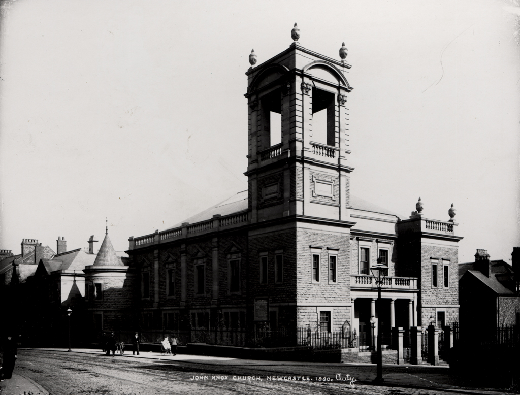
Shown on 2nd edition Ordnance Survey map. Congregation from John Knox, Clayton Street West. Built 1896 for the congregation from Clayton Street West, who were seeking larger premises. The church was in use until 1953, it later became a Boys Brigade Centre, then Factory Project House. Demolished 1983. A 1900 photograph of the church shows it terraced into the slope of the ground so that it is below the level of Elswick Road.
Easting
423180
Northing
563820
Grid Reference
NZ423180563820
Sources
2nd edition Ordnance Survey map; Peter F Ryder, 2012, Nonconformist Chapels and Meeting Houses in Newcastle and North Tyneside, a survey; Archaeological Services Durham University, 2013, Bristol Terrace, Elswick, Newcastle upon Tyne, Archaeological Assessment